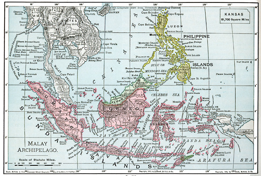
Description: A map from 1901 of the Malay Archipelago, including the Sunda Islands of Sumatra and Java, the island of Borneo, the Celebes, the Philippines, and the islands of the Banda Arafura Sea. The map shows the foreign possessions on Borneo (British), the Philippines (United States), and East Timur (Portuguese). The map shows political boundaries at the time, major cities and ports, rivers, volcanoes and mountains, coastal features, and island groups of the region. An outline map of Kansas at the same map scale is included to show comparative area size.
Place Names: Southeastern Asia, Borneo, �Celebes, �Java, �Luzon, �Philippines, �Sumatra, �Sunda Island
ISO Topic Categories: oceans,
location,
inlandWaters
Keywords: Malay Archipelago, borders, �physical, kComparativeArea, country borders, oceans,
location,
inlandWaters, Unknown, 1901
Source: James A. Bowen, Grammar School Geography (Chicago, IL: Rand, McNally & Company, 1901) 184
Map Credit: Courtesy the private collection of Roy Winkelman |
|