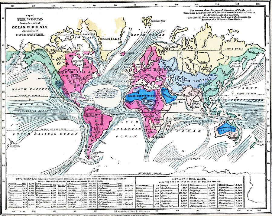
Description: A map from 1868 of the world, showing the principal ocean currents and the major river drainage basins. The map is color–coded to show the general watersheds, interior drainage basins, and riverless districts, and shows the major ocean currents with direction of flow given by arrows (seasonally alternating currents are shown with arrowheads at each end), and Atlantic Banks of Fucus or Sargasso Sea. The table at the bottom of this map lists major rivers with river lengths given in English miles and basin areas given in English square miles, and major lakes with surface areas given in English square miles.
Place Names: A Complete Map of Globes and Multi-continent, Africa, �Antarctica, �Asia, �Australia, �Europe, �North America, �South Americ
ISO Topic Categories: oceans,
inlandWaters,
location
Keywords: Map of the World showing the principal Ocean Currents and boundaries of River Systems, borders, �currents, �hydrological, �currents, oceans,
inlandWaters,
location, Unknown, 1868
Source: George W. Fitch, Outlines of Physical Geography (New York, NY: Ivison, Phinney, Blakeman & Company, 1868) 26
Map Credit: Courtesy the private collection of Roy Winkelman |
|
