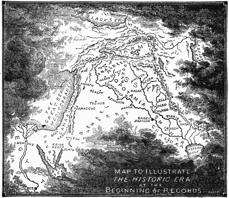
Description: A map of the region of the historic era at the beginning of records, from the southern coast of the Black Sea to the Persian Gulf, and from the Caspian Sea and Zagros Mountains to the Mediterranean and Egypt. The map shows the territories of Assyria, Armenia, Ghaldees, Gozan, Mesopotamia, Elam, Shinar, Chaldæa, Ishmael, Phoenicia, Canaan, Shur, and Egypt, the cities of Ur, Haran, Nineveh, Resen, Calah, Ellasar, Aocad, Calneh, Babylon, Susa, Erech, Hamath, Reseph, Rehoboth, Nahor, Tadmor, Damascus, Gaza, Hebron, Kadesh, Ezion Geber, Elath, Memphis, and Thebes, the rivers Nile, Euphrates, and Tigris, and Mount Ararat.
Place Names: Regional AfroAsia, Africa, �Asi
ISO Topic Categories: physical, �political, kWorldMedSea, kWorldAfroAsia, kWorldEurasia
Keywords: World at the Beginning of History, physical, �political, physical features, major political subdivisions, physical, �political, kWorldMedSea, kWorldAfroAsia, kWorldEurasia, 6000 BC
Source: William Swinton, Outlines of the World's History (New York, NY: Ivison, Blakeman, and Company, 1874) 11
Map Credit: Courtesy the private collection of Roy Winkelman |
|