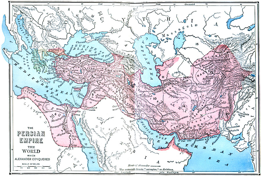
Description: A map of the Persian Empire at the time of Darius III (380–330 BC) prior to the conquest of Alexander the Great. The map shows the extent of the empire from Thrace in Europe, Egypt, Anatolia, Mesopotamia, and Persia to the Indus River. The map shows the 20 Satrapies established by Darius I, the capital in Persepolis, and the major cities of the time. Terrain features and rivers are shown.
Place Names: Regional Miscellaneous, Africa, �Asia, �Europ
ISO Topic Categories: physical, �political, kWorldMedSea, kWorldAfroAsia, kWorldEurasia
Keywords: The Persian Empire prior to the Conquest by Alexander the Great, physical, �political, physical features, major political subdivisions, physical, �political, kWorldMedSea, kWorldAfroAsia, kWorldEurasia, 330 BC
Source: William Swinton, Outlines of the World's History (New York, NY: Ivison, Blakeman, and Company, 1874) 55
Map Credit: Courtesy the private collection of Roy Winkelman |
|