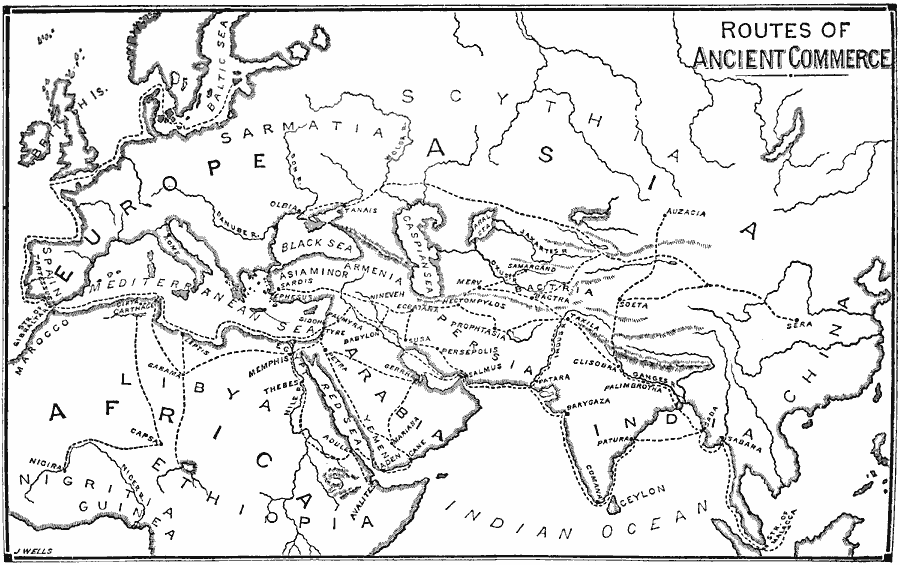
Description: A map showing ancient routes of commerce in western Asia, Africa, and Europe. "The three most commercial nations of antiquity anterior to the Greeks were the Babylonians, Phoenicians, and Carthaginians." (Swinton, 1874) The map shows the Babylonian routes to Persia, northern India, and Ceylon (Sri Lanka), the Phoenician trade routes in Arabia, Judea and Syria, Armenia, the Caspian Sea, Scythia (southern Russia), India, Spain, Britain and possibly the coast of Prussia, and the Carthaginian trade routes into central and northern Africa, Spain, and the Greek colonies in Sicily and Mediterranean Sea. Terrain features are shown, as well as oceans and seas, rivers, and major trading centers.
Place Names: Regional Miscellaneous, Africa, �Asia, �Europ
ISO Topic Categories: physical, �transportation, kWorldMedSea, kWorldAfroAsia, kWorldEurasia, kWorldEuroAfrica
Keywords: Routes of Ancient Commerce, physical, �transportation, physical features, water routes,
roads, physical, �transportation, kWorldMedSea, kWorldAfroAsia, kWorldEurasia, kWorldEuroAfrica, 500 BC
Source: William Swinton, Outlines of the World's History (New York, NY: Ivison, Blakeman, and Company, 1874) 65
Map Credit: Courtesy the private collection of Roy Winkelman |
|