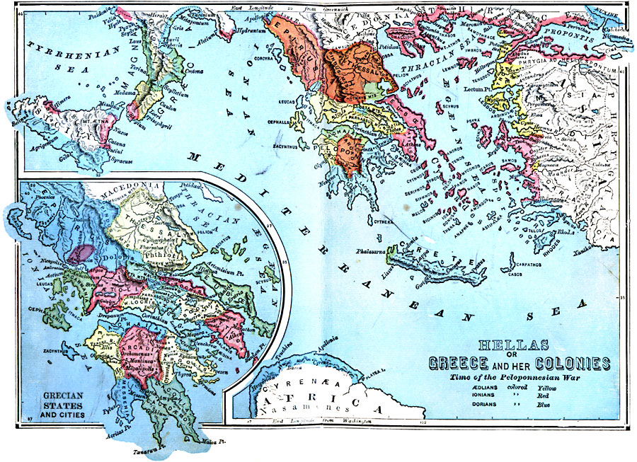
Description: A map of ancient Hellas or Greece and her colonies at the time of the Peloponnesian War (431–404 BC) between Athens and allies against the Peloponnesian League led by Sparta. The map is color–coded to show the territories of the &Aelig;olians, Ionians, and Dorians, important cities, terrain, rivers, coastal features, and islands, and includes an inset map detailing the mainland Grecian states and cities. "The name by which the Greeks always called their country is Hellas. This term, however, included more than is now covered by the term Greece; for it comprised not only the adjacent islands, but also patches of settlement around the Mediterranean Sea. Hellas, in fact, denotes wherever the Hellenes, or Greeks, were settled. [...] Other settlements were made by the Greeks, of which the most notable were those on the coasts of Thrace and Macedonia, on the islands west of Greece, in Sicily, in Lower Italy (hence called Magna Græcia or Great Greece), and the territory of Cyrene, or the Cyrenaica, along the northern coast of Africa. Some outposts of Hellenic settlement were planted as far east as the shores of the Euxine Sea, and one colony arose in the extreme western part of the Mediterranean at Massilia, now Marseilles." — Swinton, 1874, pp. 75 and 82.
Place Names: Mediterranean Europe, Greec
ISO Topic Categories: boundaries,
location,
oceans,
inlandWaters
Keywords: Greece and Her Colonies, physical, kAncientGreece, physical features, boundaries,
location,
oceans,
inlandWaters, 431–404 BC
Source: William Swinton, Outlines of the World's History (New York, NY: Ivison, Blakeman, and Company, 1874) 72
Map Credit: Courtesy the private collection of Roy Winkelman |
|
