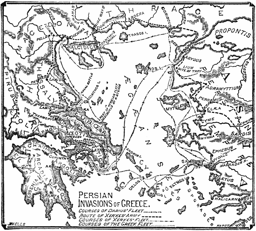
Description: A map of the Ægean Sea region, including Greece and coastal Asia Minor, during the period of the Persian Invasion (Greco–Persian Wars) from 499 to 479 BC. This map shows the route of the Persian fleet under Darius the Great from Samos across the Ægean to Marathon, the route of the Persian army under Xerxes from Sardis through Thrace and Macedonia to Athens, the route of the Persian fleet under Xerxes, and the course of the Greek fleet from the northern coast of Euboea to Salamis and Mycale (Asia Minor). Significant locations such as the crossing of the Hellespont at Abydus, and important battle sites including Marathon, the naval battle north of Euboea (Artemisium), Thermopylae, Gulf of Salamis, Platæa, and Mycale.
Place Names: Southeastern Europe, Greece, �Macedoni
ISO Topic Categories: boundaries,
location,
oceans,
inlandWaters,
transportation,
intelligenceMilitary
Keywords: Persian Invasions of Greece, physical, �political, �transportation, kAncientGreece, physical features, water routes, boundaries,
location,
oceans,
inlandWaters,
transportation,
intelligenceMilitary, 499–479 BC
Source: William Swinton, Outlines of the World's History (New York, NY: Ivison, Blakeman, and Company, 1874) 92
Map Credit: Courtesy the private collection of Roy Winkelman |
|