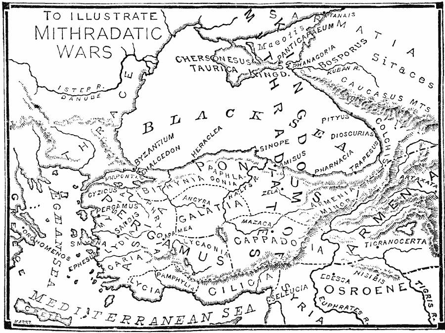
Description: A map of the Pontus (Black Sea) region during the Mithridatic Wars fought between Mithridates VI of Pontus and the Roman Republic between 88 and 63 BC. The map shows the Kingdom of Mithridates in the eastern Black Sea region, the provinces of Asia Minor at the time, and major cities.
Place Names: Southwest Asia, Syria, �Turkey, �Greec
ISO Topic Categories: boundaries,
inlandWaters,
location,
oceans
Keywords: The Mithradatic Wars, physical, �political, physical features, major political subdivisions, boundaries,
inlandWaters,
location,
oceans, 88–63 BC
Source: William Swinton, Outlines of the World's History (New York, NY: Ivison, Blakeman, and Company, 1874) 161
Map Credit: Courtesy the private collection of Roy Winkelman |
|