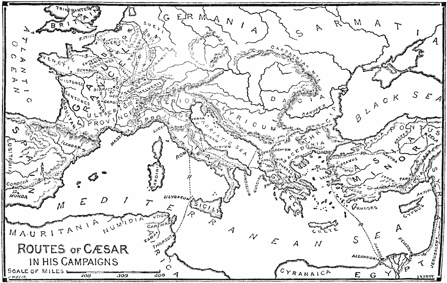
Description: A map showing the campaigns of Julius Caesar from 58 to 44 BC. The map shows the routes of his campaigns and battle sites in Gaul (58–51 BC), including (1) the Battle of the Arar and Battle of Bibracte, (2) into Belgæ (Belgium), (3) to the western Veneti Coast of Gaul and the Battle of Alesia, across the Rhine (4), to Britain (5), to Belgium (6) and the Battle of Atuatuca Tungrorum, the final campaign in Gaul (7) and the Battle of Gergovia, and the routes of the Great Roman Civil War (49–44 BC) shown as routes (8) across the Rubicon River, (9) into Hispania and the Battle of Ilerda, the Greek and Africa campaign (10) and the battles of Dyrrhachium, Pharsalus, Zela, the campaign to North Africa (11) and the Battle of Thapsus, and the second campaign into Hispanis (12) and the Battle of Munda.
Place Names: Western and Central Europe, Italy, �Greece, �France, �Spain, �Macedoni
ISO Topic Categories: intelligenceMilitary,
inlandWaters,
location,
oceans
Keywords: Routes of Caesar, physical, �transportation, kRomanEmpire, physical features, water routes, intelligenceMilitary,
inlandWaters,
location,
oceans, 58–44 BC
Source: William Swinton, Outlines of the World's History (New York, NY: Ivison, Blakeman, and Company, 1874) 167
Map Credit: Courtesy the private collection of Roy Winkelman |
|