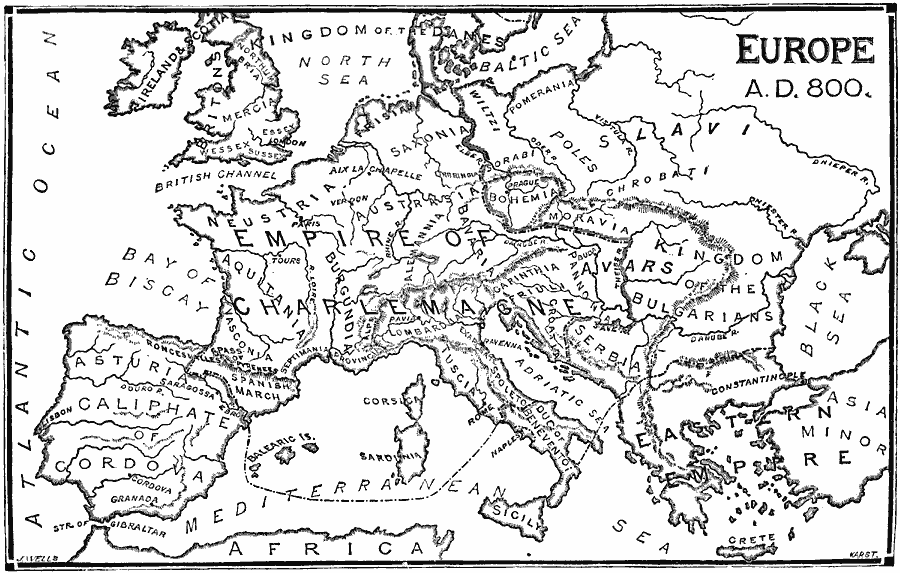
Description: A map of Western Europe around AD 800 showing the extent of the Empire of Charlemagne, the Asturia Caliphate of Cordova (Iberian Peninsula), the Kingdom of the Danes extending to England, Kingdom of the Bulgarians, the Eastern Empire, and the territories east of the River Elber.
Place Names: Western and Central Europe, Asturi Caliphate, �Britons, �Serbia, �Charlemaign
ISO Topic Categories: boundaries,
transportation,
inlandWaters,
location,
oceans
Keywords: Europe, physical, �political, physical features, major political subdivisions, boundaries,
transportation,
inlandWaters,
location,
oceans, AD 800
Source: William Swinton, Outlines of the World's History (New York, NY: Ivison, Blakeman, and Company, 1874) 233
Map Credit: Courtesy the private collection of Roy Winkelman |
|