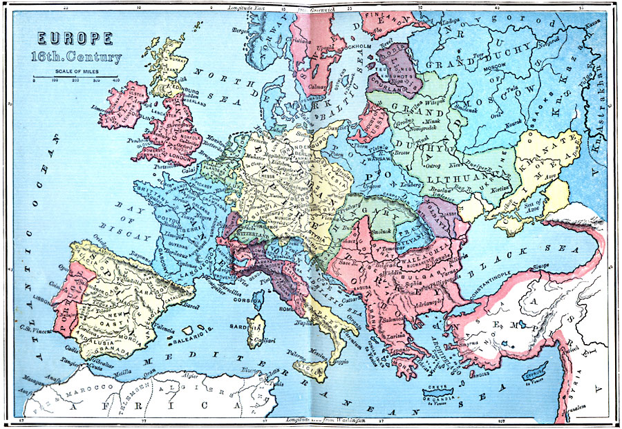
Description: A map of Europe during the ‘Period of Transition’ from medieval to modern history, showing the political boundaries in the first half of the 16th century. "This period will embrace several marked events and revolutions in affairs: as, the destruction of the Eastern Empire; the maritime discovery of America and the circumnavigation of Africa; the invention of printing and the revival of learning; the invention of gunpowder, with consequent changes in the art of war and in the organization of society; the decline of feudalism and the establishment of centralized monarchies." — Swinton, 1874, p. 306.
Place Names: A Complete Map of Europe, France, �Germany, �Portugal, �Spain, �Poland, �England, �Scotland, �Ireland, �Norway, �Sweden, �Finland, �Switzerland, �Italy, �Turke
ISO Topic Categories: boundaries,
inlandWaters,
location,
oceans
Keywords: Europe at the Beginning of Modern History, physical, �political, physical features, country borders,
major political subdivisions, boundaries,
inlandWaters,
location,
oceans, Sixteenth Century
Source: William Swinton, Outlines of the World's History (New York, NY: Ivison, Blakeman, and Company, 1874) 305
Map Credit: Courtesy the private collection of Roy Winkelman |
|
