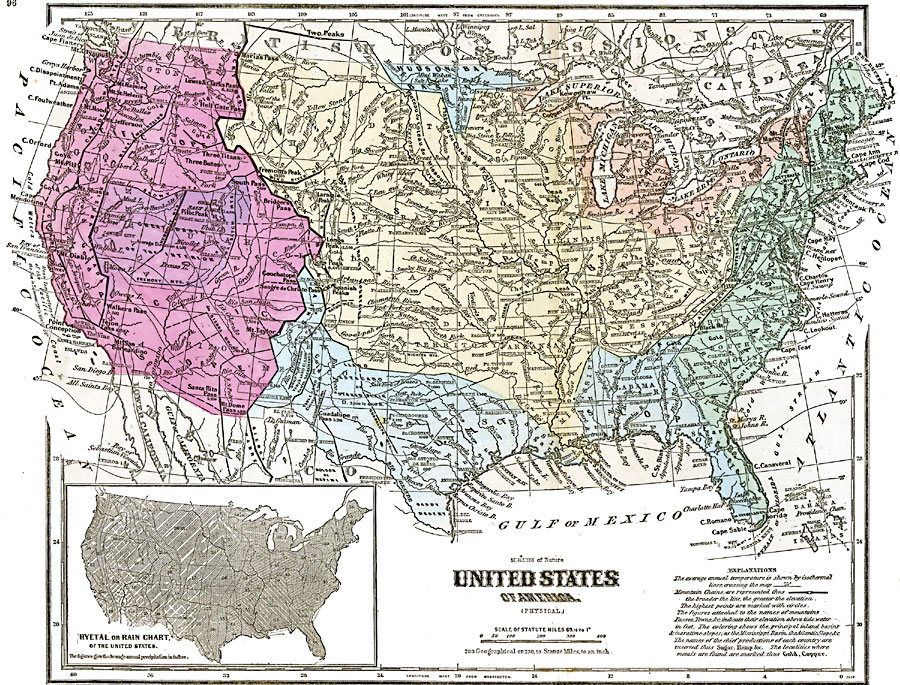
Description: A map from 1868 of the United States showing physical features, mean annual temperatures, rainfall distribution, watersheds, and principal products in the area. The average annual temperatures are shown by isotherms, with temperatures given in degrees Fahrenheit. Mountain chains are represented by black lines of varying thickness, with thicker lines indicating greater elevations, and the highest points marked by circles. The figures attached to the names of peaks, passes, lakes, and towns indicate their elevation above tide water in feet. The colored areas of the map indicate watersheds, inland basins, and maritime slopes. The names of chief products and metals are given in their respective areas on the map. An inset Hyetal or rain chart shows rainfall distribution, giving mean annual precipitation measured in inches.
Place Names: A Complete Map of the United States, Boston, �Chicago, �Houston, �Los Angeles, �Miami, �New Orleans, �New York, �San Diego, �Seattle, �Washington D.C
ISO Topic Categories: oceans,
location,
inlandWaters,
elevation,
climatologyMeteorologyAtmosphere
Keywords: Climate and Watersheds of the United States, borders, �currents, �physical, �temperature, �topographical, �hydrological, �meteorological, kClimate, kHydrologic, topographical, country borders, climate,
temperature, currents, oceans,
location,
inlandWaters,
elevation,
climatologyMeteorologyAtmosphere, Unknown, 1868
Source: George W. Fitch , Outlines of Physical Geography (New York, NY: Ivison, Phinney, Blakeman & Company, 1868) 96-97
Map Credit: Courtesy the private collection of Roy Winkelman |
|