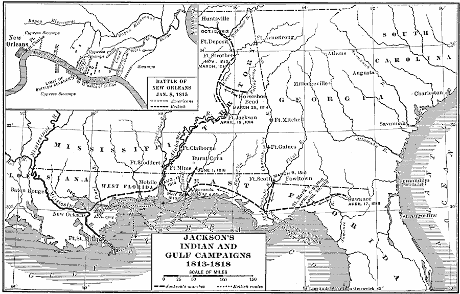
Description: A map of the Gulf region showing the campaigns of Andrew Jackson during the Red Stick War with the Creeks (1813–1814), his campaign to New Orleans during the War of 1812 (1815), and during the First Seminole War (1817–1818). The map shows forts and battle sites with dates given, and includes an inset map detailing the Battle of New Orleans (January 8, 1815). The map is keyed to show the routes of Jackson and the British route in the Gulf to New Orleans.
Place Names: Growth of Nation, Alabama, �Florida, �Georgia, �Louisiana, �Mississippi, �South Carolina, ��War of 181
ISO Topic Categories: oceans,
location,
inlandWaters
Keywords: Jackson's Indian and Gulf Campaigns, borders, �historical, historical event, oceans,
location,
inlandWaters, Unknown, 1813–1818
Source: Dixon Ryan Fox, Harper's Atlas of American History (New York, NY: Harper & Brothers Publishers , 1920) 31
Map Credit: Courtesy the private collection of Roy Winkelman |
|
