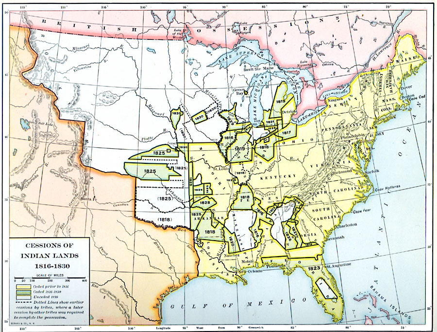
Description: A map of the United States showing the cession of Native American lands between 1816 and 1830. The map is color–coded to show the lands ceded prior to 1816, the lands ceded between 1816 and 1830 with dates of cession given, and areas unceded in 1830. Dotted lines show the areas of earlier cessions where a later cession by later tribes was required to complete the possession by the United States.
Place Names: Growth of Nation, Alabama, �Arkansas, �Connecticut, �Delaware, �Florida, �Georgia, �Louisiana, �Maine, �Maryland, �Mississippi, �Missouri, �New Hampshire, �New Jersey, �New York, �North Carolina, �South Carolina, �Tennessee, �Vermont, �Virginia, �Native Americans, �Na
ISO Topic Categories: oceans,
location,
inlandWaters
Keywords: Cessions of Native American Lands, borders, �historical, kNativeAmerican, historical event, oceans,
location,
inlandWaters, Unknown, 1816–1830
Source: Dixon Ryan Fox, Harper's Atlas of American History (New York, NY: Harper & Brothers Publishers , 1920) 32
Map Credit: Courtesy the private collection of Roy Winkelman |
|