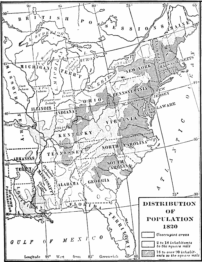
Description: A population map of United States and territories in 1820 showing the distribution of the European–American population at the time and the general tribal lands of the Native Americans east of the Mississippi River. The map shows the State lines, rivers, and is keyed to show unoccupied areas (European–American), areas of population densities of 2 to 18 inhabitants per square mile, and areas of population densities of 18 to over 90 inhabitants per square mile.
Place Names: Demographics, Alabama, �Delaware, �Georgia, �Illinois, �Indiana, �Kentucky, �Louisiana, �Maine, �Maryland, �Mississippi, �New Jersey, �North Carolina, �Ohio, �Pennsylvania, �South Carolina, �Tennessee, �Virginia, �populatio
ISO Topic Categories: oceans,
location,
inlandWaters
Keywords: Distribution of Population, population, �statistical, kPopulation, population, oceans,
location,
inlandWaters, Unknown, 1820
Source: Dixon Ryan Fox, Harper's Atlas of American History (New York, NY: Harper & Brothers Publishers , 1920) 33
Map Credit: Courtesy the private collection of Roy Winkelman |
|