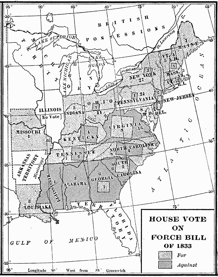
Description: A map of the United States showing the results of the House vote on the Force Bill of 1833 during the presidency of Andrew Jackson. The map is keyed to show the areas of votes for or against the bill. The bill authorized Jackson to use whatever force necessary to enforce tariffs, including the authority to close ports or harbors at his will. An important part of the Force Bill was to deny the right of secession to individual states, since the principle of secession would no longer be in keeping with the idea of a national union.
Place Names: Elections, Alabama, �Arkansas Territory, �Connecticut, �Delaware, �Florida Territory, �Georgia, �Illinois, �Indiana, �Kentucky, �Louisiana, �Maryland, �Michigan Territory, �Mississippi, �Missouri, �New Hampshire, �New Jersey, �New York, �North Carolina, �Ohio, �
ISO Topic Categories: oceans,
location,
inlandWaters
Keywords: House Vote on the Force Bill, historical, historical event, oceans,
location,
inlandWaters, Unknown, 1833
Source: Dixon Ryan Fox, Harper's Atlas of American History (New York, NY: Harper & Brothers Publishers , 1920) 39
Map Credit: Courtesy the private collection of Roy Winkelman |
|