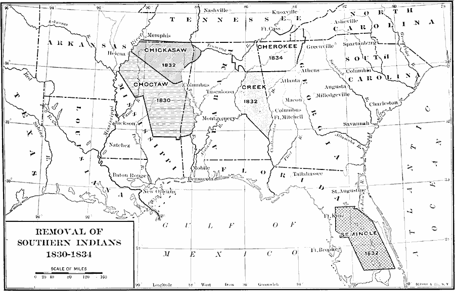
Description: A map of the southeastern United States showing the lands of the Five Civilized Tribes (Cherokee, Chickasaw, Choctaw, Creek or Muscogee, and Seminole), indicating the dates of removal to Indian Territory (Oklahoma) under the Indian Removal Act of 1830. The dates include the Treaty of Dancing Rabbit Creek (Choctaw, 1830), the Federal purchase of Chickasaw lands and the forced removal of the Creek and Seminole, (1832), the Treaty of Payne's Landing (Seminole, 1832), and the Treaty of New Echota (Cherokee, 1835). Seminole resistance led to the Second Seminole War (1835–1842).
Place Names: Southern States, Alabama, �Arkansas, �Florida Territory, �Georgia, �Louisiana, �Mississippi, �North Carolina, �South Carolina, �Tennessee,
ISO Topic Categories: oceans,
location,
inlandWaters
Keywords: Removal of Southern Indians, historical, kNativeAmerican, historical event, oceans,
location,
inlandWaters, Unknown, 1830–1834
Source: Dixon Ryan Fox, Harper's Atlas of American History (New York, NY: Harper & Brothers Publishers , 1920) 39
Map Credit: Courtesy the private collection of Roy Winkelman |
|