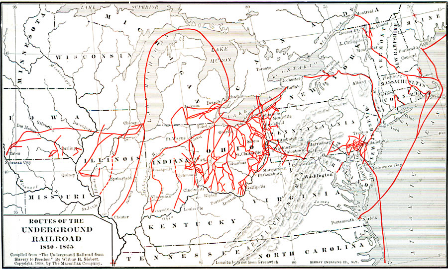
Description: A map of the north–central United States showing the routes of the Underground Railroad 1830—1865, showing the principal routes used by slaves to the free states and Canada. "After 1833 the slave who reached Canada was free by British statute, and there were many sympathizers in the North who were willing to aid him on his way. Their efforts, of course, were secret, by reason of the fugitive–slave law, and their system came to be known as the ‘Underground Railroad.’" — Fow, 1920, p. 159.
Place Names: Miscellaneous United States, Connecticut, �Delaware, �Kentucky, �Maine, �Massachusetts, �Missouri, �New Hampshire, �New Jersey, �New York, �North Carolina, �Ohio, �Pennsylvania, �Rhode Island, �Vermont, �Virginia, �Slavery, �Confederate territor
ISO Topic Categories: oceans,
location,
inlandWaters
Keywords: Routes of the Underground Railroad, borders, �historical, �slavery, � historical event, oceans,
location,
inlandWaters, Unknown, 1830–1865
Source: Dixon Ryan Fox, Harper's Atlas of American History (New York, NY: Harper & Brothers Publishers , 1920) 41
Map Credit: Courtesy the private collection of Roy Winkelman |
|