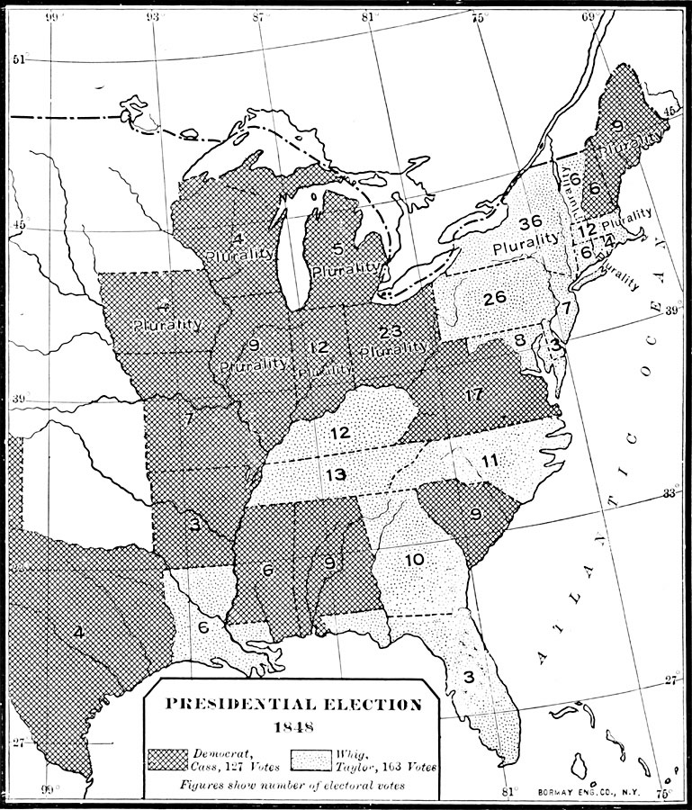
Description: A map of the United States showing the results of the 1848 presidential election. The map is keyed to show the states carried by the Whigs (Zachary Taylor)and Democrats (Lewis Cass). The figures indicate the number of Electoral Votes for each State.
Place Names: Elections, Delaware, �Georgia, �Indiana, �Kentucky, �Maine, �Maryland, �New Jersey, �North Carolina, �Pennsylvania, �South Carolina, �Tennessee, �Virginia, �Presidential Electio
ISO Topic Categories: oceans,
location,
inlandWaters
Keywords: Presidential Election , election, �statistical, �historical, � historical event, oceans,
location,
inlandWaters, Unknown, 1848
Source: Dixon Ryan Fox, Harper's Atlas of American History (New York, NY: Harper & Brothers Publishers , 1920) 44
Map Credit: Courtesy the private collection of Roy Winkelman |
|