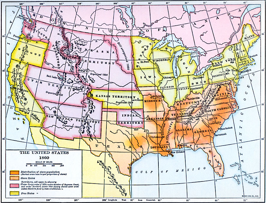
Description: A map of the United States in 1860 showing the states and territory boundaries at the time, and is color–coded to show the slave States and distribution of slaves, the free states, and the territories, all open to slavery under the Compromise of 1850 (under the decision of the Supreme Court and under Southern claims that slavery should exist until status should be fixed by state constitution, pending the statehood of the territory).
Place Names: A Complete Map of the United States, Alabama, �Arkansas, �Connecticut, �Delaware, �Florida, �Georgia, �Indian Territory, �Indiana, �Kansas Territory, �Kentucky, �Maine, �Maryland, �Massachusetts, �Michigan, �Mississippi, �Missouri, �New Jersey, �New Mexico Territory, �New York, �North C
ISO Topic Categories: oceans,
location,
inlandWaters
Keywords: The United States , historical, �slavery, country borders, roads,
water routes, historical event, oceans,
location,
inlandWaters, Unknown, 1860
Source: Dixon Ryan Fox, Harper's Atlas of American History (New York, NY: Harper & Brothers Publishers , 1920) 55
Map Credit: Courtesy the private collection of Roy Winkelman |
|