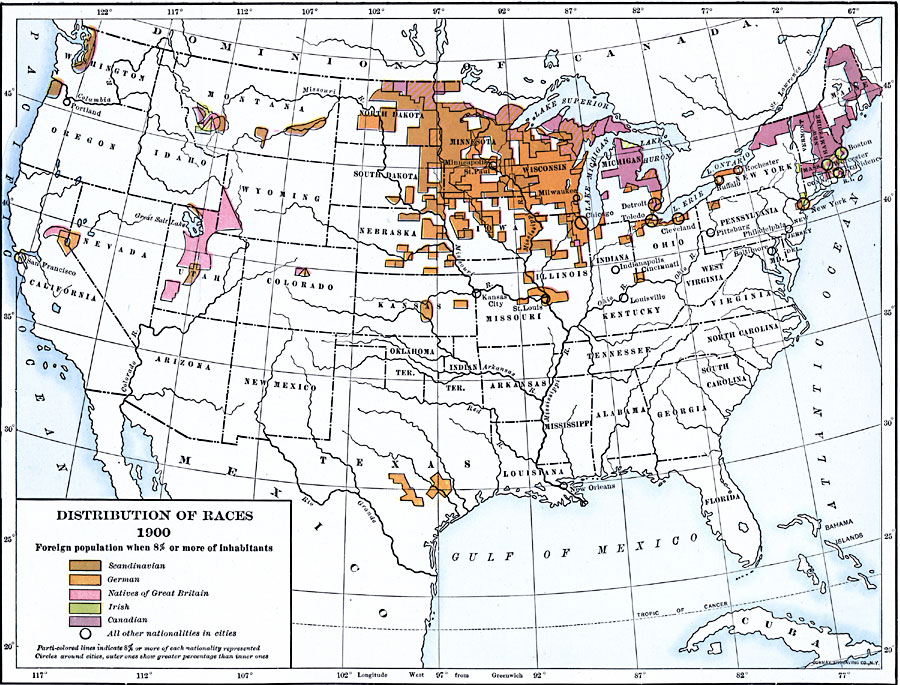
Description: A map from 1920 of the United States showing concentrations and distribution of various European ethnic groups in 1900. The map is color–coded to show foreign populations where 8 percent or more of the inhabitants are Scandinavian, German, Natives of Great Britain, Irish, or Canadians. Parti–colored lines indicate 8 percent or more of each nationality represented.
Place Names: Demographics, Arizona, �California, �Colorado, �Idaho, �Montana, �Nevada, �New Mexico, �Oregon, �Utah, �Washington, �Wyoming,
ISO Topic Categories: oceans,
location,
inlandWaters
Keywords: Distribution of European Races in the United States, ethnological, �statistical, kEthnic, population,
ethnological, oceans,
location,
inlandWaters, Unknown, 1900
Source: Dixon Ryan Fox, Harper's Atlas of American History (New York, NY: Harper & Brothers Publishers , 1920) 75
Map Credit: Courtesy the private collection of Roy Winkelman |
|