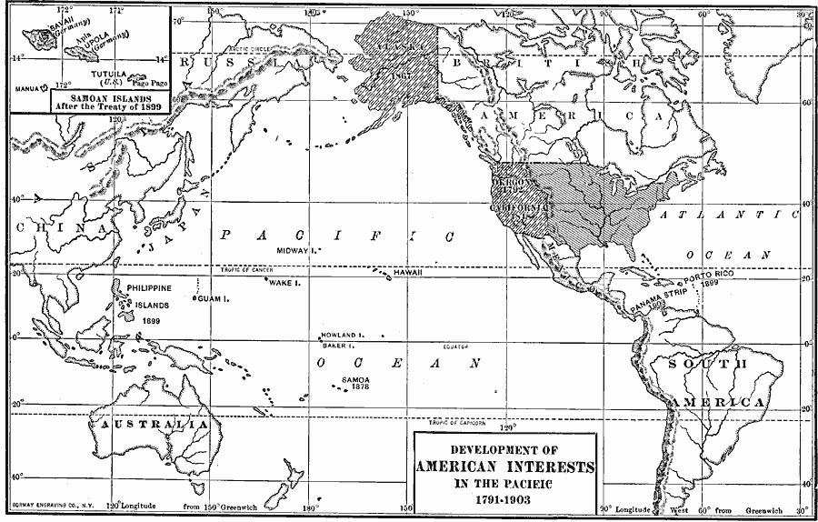
Description: A map of the United States and Pacific Ocean showing the development of American interests in the Pacific from the early exploration of Oregon Country in 1791 to the formal annexation of the Midway Islands and the Panama Strip in 1903. The map shows the Alaska Territory purchased from Russia in 1846, the admission of California in 1848, the territories of Puerto Rico, Guam, and Philippine Islands acquired after the Spanish–American War in 1898, the annexation of Hawaii under the Newlands Resolution of 1898, Wake Island in 1899, and includes an inset map of American Samoa under treaty with the Germans in 1899.
Place Names: Growth of Nation, Alaska, �Asia, �Australia, �California, �China, �Japan, �North America, �Oregon, �South Americ
ISO Topic Categories: oceans,
location,
inlandWaters,
economy
Keywords: Development of American Interests in the Pacific, economic, �industry, �statistical, industry,
economic, historical event, oceans,
location,
inlandWaters,
economy, Unknown, 1791–1903
Source: Dixon Ryan Fox, Harper's Atlas of American History (New York, NY: Harper & Brothers Publishers , 1920) 80
Map Credit: Courtesy the private collection of Roy Winkelman |
|