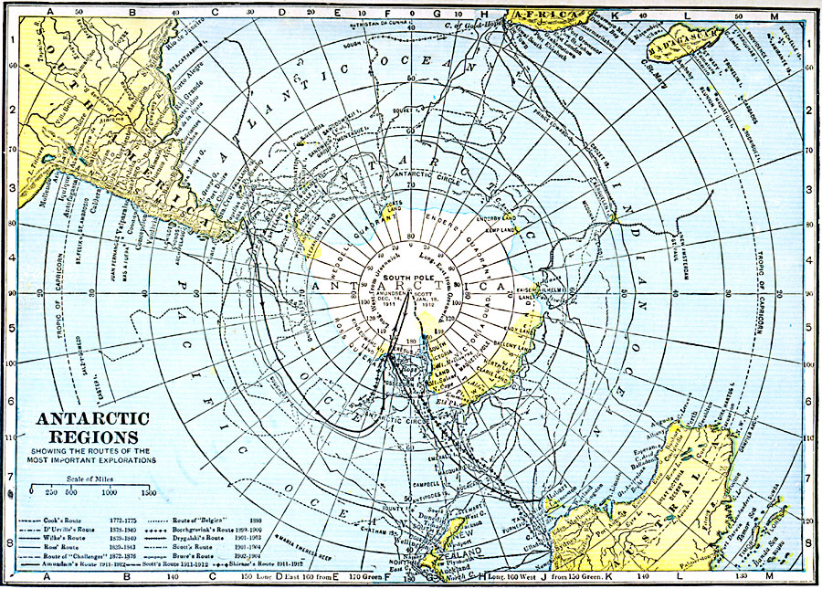
Description: A map of the South Polar Region from 1921 showing the routes of several Antarctic explorations. The map shows the date Amundsen first reached the South Pole (December 16, 1911), and routes of Cook (1772–1775), D'Urville (1838–1840), Wilke (1839–1840), Ross (1839–1843), Borchgrevink (1898–1900), Drygalaki (1901–1903), Scott (1901–1904), Bruce (1902–1904), and Shackleton (1909). This map shows Antarctica divided into the Wendell Quadrant, Enderby Quadrant, Victoria Quadrant, and Ross Quadrant.
Place Names: Antarctic Region, Africa, �Australia, �Madagascar, �New Zealand, �South Americ
ISO Topic Categories: oceans,
location,
inlandWaters
Keywords: Antarctic Regions, borders, �expedition, �physical, �historical, country borders, historical event, oceans,
location,
inlandWaters, Unknown, 1921
Source: L.L. Poates, Poates Complete Atlas of the World (New York, NY: Poates Corporation , 1921) 3
Map Credit: Courtesy the private collection of Roy Winkelman |
|