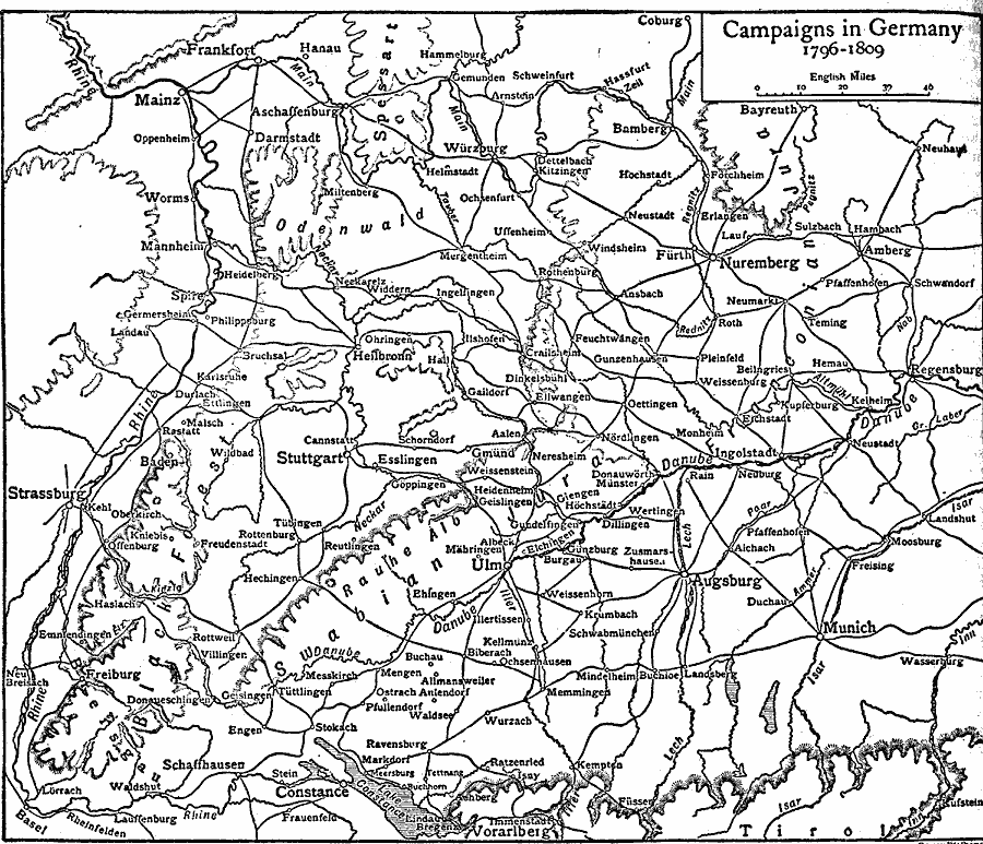
Description: A map of western Germany between 1796 and 1809 showing the campaigns in the region by France under Napoleon Bonaparte. The map shows major cities, roads, rivers, and terrain features of the region, including the sites of the 1796 campaign of Ulm, Augsburg, and Amberg, the site of the 1799 campaign of Stockach, the 1800 campaign sites of Stockach, Engen, Messkirch, Biberach, and Munich, the Ulm campaign of 1805, the campaigns of the war of the Fourth Coalition (1806–1807), and the War of the Fifth Coalition (1809).
Place Names: Germany, Frankfurt am Main, �Nurember
ISO Topic Categories: inlandWaters,
location,
transportation,
intelligenceMilitary
Keywords: Napoleonic Campaigns, transportation, �physical, kNapoleonicWars, physical features, roads, inlandWaters,
location,
transportation,
intelligenceMilitary, Unknown, 1796–1809
Source: The Encyclopedia Britannica, The Encyclopedia Britannica Vol 19 (New York, NY: The Encyclopedia Britannica Company, 1911) 218
Map Credit: Courtesy the private collection of Roy Winkelman |
|