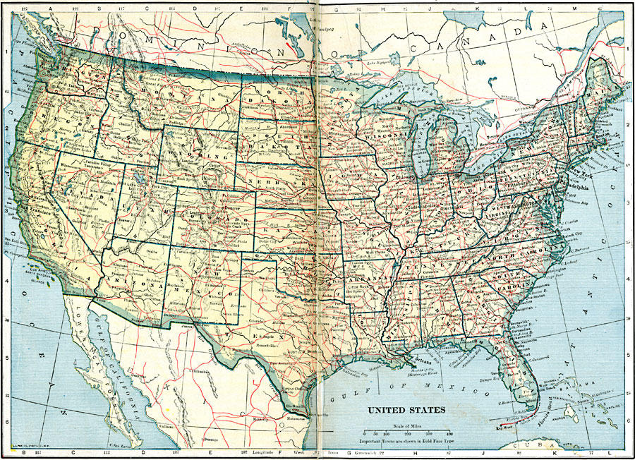
Description: A map from 1921 of the United States showing state boundaries and capitals, major cities and towns, railroads, canals, mountain systems, lakes, rivers, and coastal features.
Place Names: A Complete Map of the United States, Boston, �Chicago, �Houston, �Los Angeles, �Miami, �New Orleans, �New York, �San Diego, �Seattle, �Washington D.C
ISO Topic Categories: oceans,
location,
inlandWaters,
transportation
Keywords: United States, borders, �physical, �railroads, �transportation, �country borders,
county borders, railroads, oceans,
location,
inlandWaters,
transportation, Unknown, 1921
Source: L.L. Poates, Poates Complete Atlas of the World (New York, NY: Poates Corporation , 1921) 24-25
Map Credit: Courtesy the private collection of Roy Winkelman |
|