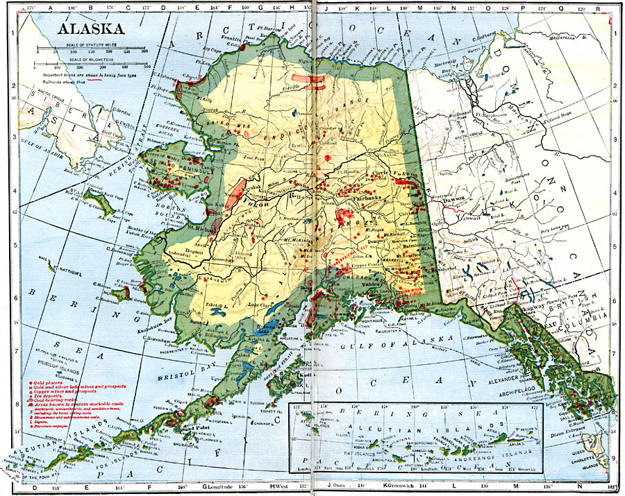
Description: A map of Alaska from 1914 showing the State capital at Juneau, cities, towns, ports, railroads, submarine telegraph lines, major rivers and lakes, mountains, coastal features, and islands. The map is keyed to show gold placers, gold and silver mines and prospects, copper mines and prospects, tin deposits, coal bearing rock and workable coals, and petroleum seepages.
Place Names: Alaska, Anchorage, �Cordova, �Fairbanks, �Juneau, �Kenai, �Kodiak, �Nome, �Palmer, �Sitka, �Skagwa
ISO Topic Categories: oceans,
location,
inlandWaters,
transportation
Keywords: Alaska, borders, �geological, �physical, �railroads, �transportation, kResources, geological, country borders,
county borders, railroads, oceans,
location,
inlandWaters,
transportation, Unknown, 1919
Source: L.L. Poates, Poates Complete Atlas of the World (New York, NY: Poates Corporation , 1921) 26-27
Map Credit: Courtesy the private collection of Roy Winkelman |
|