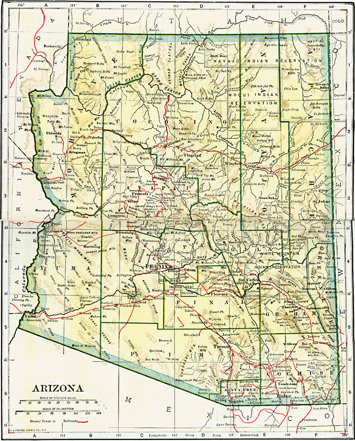
Description: A map of Arizona from 1919 showing the State capital of Phoenix, counties and county seats, major cities and towns, railroad lines, Indian reservations, mountains, rivers, and the Grand Canyon.
Place Names: Arizona, Bisbee, �Clifton, �Douglas, �Globe, �Jerome, �Nogales, �Phoenix, �Prescott, �Tucson, �Yum
ISO Topic Categories: oceans,
location,
inlandWaters,
transportation
Keywords: Arizona, borders, �physical, �railroads, �transportation, kNativeAmerican, country borders,
county borders, railroads, oceans,
location,
inlandWaters,
transportation, Unknown, 1919
Source: L.L. Poates, Poates Complete Atlas of the World (New York, NY: Poates Corporation , 1921) 30-31
Map Credit: Courtesy the private collection of Roy Winkelman |
|