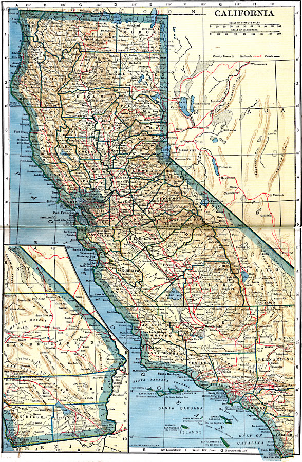
Description: A map of California from 1919 showing the State capital of Sacramento, counties and county seats, major cities and towns, railroads, mountain systems, lakes, rivers, and coastal features. An inset map shows the continuation of the southeast part of the state.
Place Names: California, Eureka, �Humboldt, �Los Angeles, �Oakland, �Redding, �Sacramento, �San Diego, �San Francisco, �Santa Barbara, �Stockto
ISO Topic Categories: oceans,
location,
inlandWaters,
transportation
Keywords: California, borders, �physical, �railroads, �transportation, �country borders,
county borders, railroads, oceans,
location,
inlandWaters,
transportation, Unknown, 1919
Source: L.L. Poates, Poates Complete Atlas of the World (New York, NY: Poates Corporation , 1921) 34-35
Map Credit: Courtesy the private collection of Roy Winkelman |
|