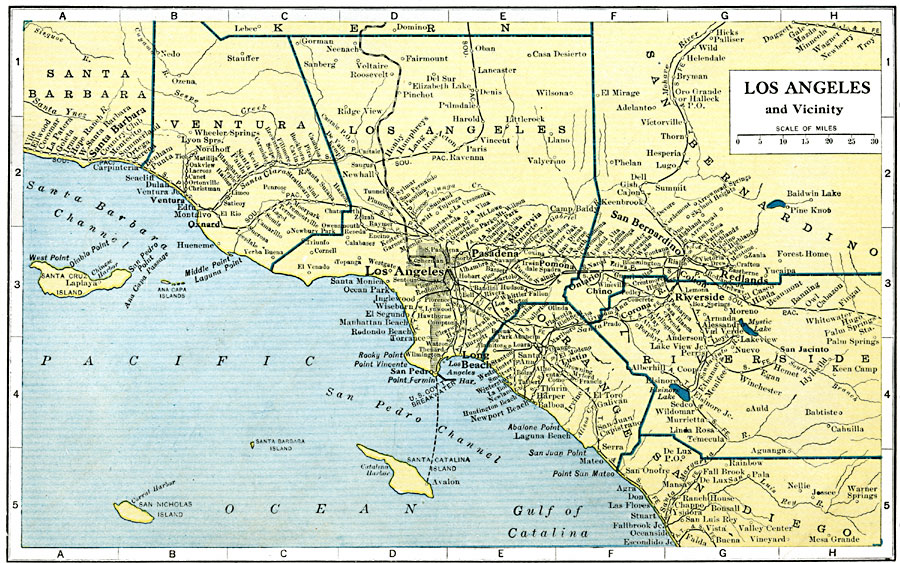
Description: A map from 1919 of Los Angeles, California and surrounding vicinity, showing the cities and towns from Santa Barbara south to Escondido, and inland to Redlands and San Bernardino. The map shows the railroads and train stops in the area.
Place Names: California, Long Beach, �Los Angeles, �Pasadena, �Pomon
ISO Topic Categories: oceans,
location,
inlandWaters
Keywords: Los Angeles and Vicinity, borders, �physical, �country borders, oceans,
location,
inlandWaters, Unknown, 1919
Source: L.L. Poates, Poates Complete Atlas of the World (New York, NY: Poates Corporation , 1921) 36
Map Credit: Courtesy the private collection of Roy Winkelman |
|