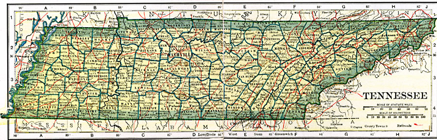
Description: A map from 1919 of Tennessee showing the capital Nashville, counties and county seats, principal cities and towns, railroads, mountains, and rivers.
Place Names: Tennessee, Chattanooga, �Clarksville, �Clinton, �Columbia, �Knoxville, �Memphis, �Nashville, �Shelbyville, �Sparta, �Tro
ISO Topic Categories: oceans,
location,
inlandWaters,
transportation
Keywords: Tennessee, borders, �physical, �railroads, �transportation, �country borders,
county borders, railroads, oceans,
location,
inlandWaters,
transportation, Unknown, 1919
Source: L.L. Poates, Poates Complete Atlas of the World (New York, NY: Poates Corporation , 1921) 58-59
Map Credit: Courtesy the private collection of Roy Winkelman |
|