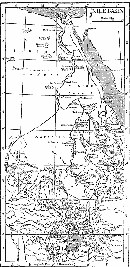
Description: A map from 1911 of the Nile River basin, showing the watershed dividing line between the Nile drainage, Congo drainage, and the coastal drainage systems to the Red Sea and Indian Ocean. The map shows the Nile River headwaters in Lake Victoria, and the tributaries of the river system.
Place Names: Egypt, Alexandria, �Cairo, �Rosetta, �Sue
ISO Topic Categories: boundaries,
location,
oceans,
inlandWaters
Keywords: The Nile Basin, physical, physical features, boundaries,
location,
oceans,
inlandWaters, Unknown, 1911
Source: The Encyclopedia Britannica, The Encyclopedia Britannica Vol 19 (New York, NY: The Encyclopedia Britannica Company, 1911) 693
Map Credit: Courtesy the private collection of Roy Winkelman |
|