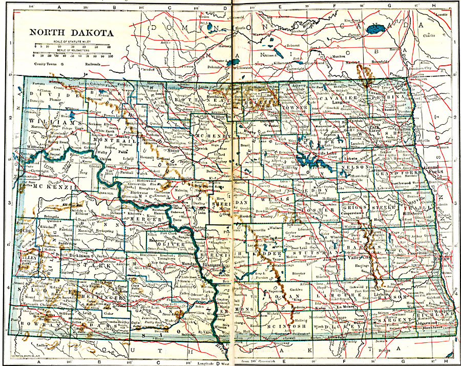
Description: A map from 1919 of North Dakota, showing the capital of Bismarck, counties and county seats, principal cities and towns, Indian reservations, railroads, mountains, lakes, and rivers
Place Names: North Dakota, Bismarck, �Casselton, �Fargo, �Ft. Buford, �Grafton, �Grand Forks, �Jamestown, �Pembina, �Valley City, �Wahpeto
ISO Topic Categories: oceans,
location,
inlandWaters,
transportation
Keywords: North Dakota, borders, �physical, �railroads, �transportation, kNativeAmerican, country borders,
county borders, railroads, oceans,
location,
inlandWaters,
transportation, Unknown, 1919
Source: L.L. Poates, Poates Complete Atlas of the World (New York, NY: Poates Corporation , 1921) 94-95
Map Credit: Courtesy the private collection of Roy Winkelman |
|