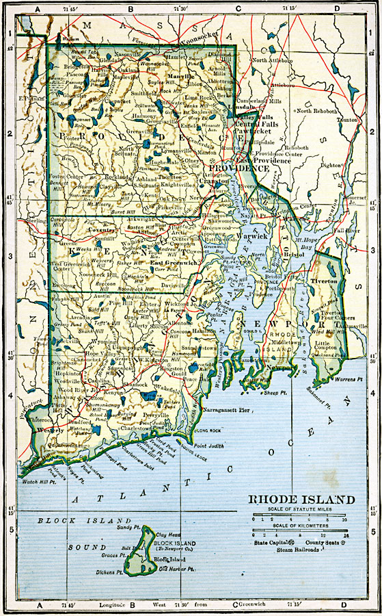
Description: A map from 1919 of Rhode Island showing the capital at Providence, counties and county seats, principal cities, towns, and ports, steam railroad lines, terrain, lakes, rivers, and coastal features.
Place Names: Rhode Island, Bristol, �Greenwich, �Kingston, �Narragansett Pier, �Newport, �Pawtucket, �Providence, �Warren, �Warwick, �Woonsocke
ISO Topic Categories: oceans,
location,
inlandWaters,
transportation
Keywords: Rhode Island, borders, �physical, �railroads, �transportation, country borders,
county borders, railroads, oceans,
location,
inlandWaters,
transportation, Unknown, 1919
Source: L.L. Poates, Poates Complete Atlas of the World (New York, NY: Poates Corporation , 1921) 109
Map Credit: Courtesy the private collection of Roy Winkelman |
|