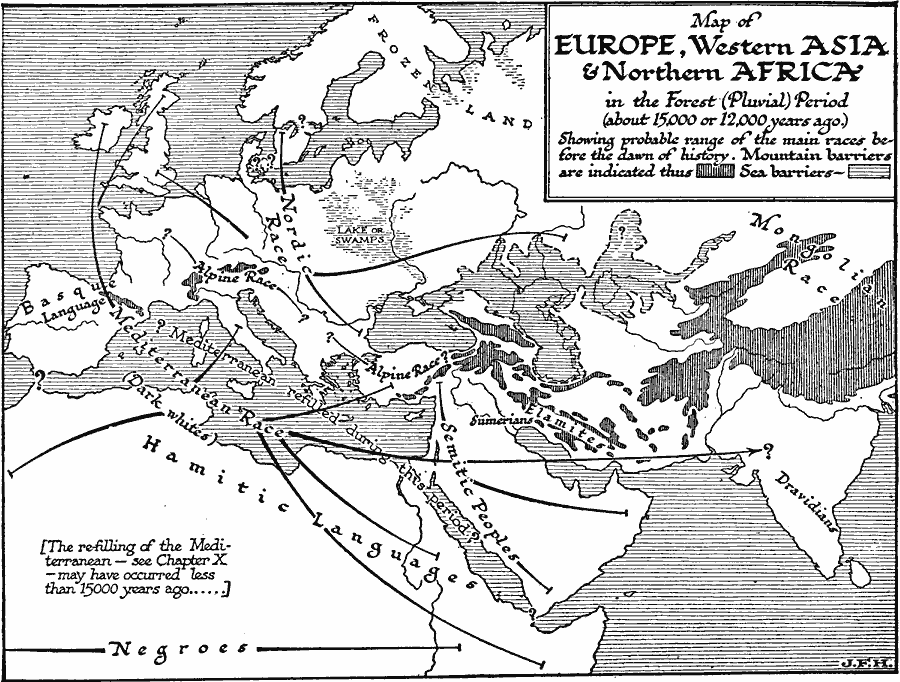
Description: A map of Europe, western Asia, and northern Africa in the Forest (Pluvial) period, about 15,000 or 12,000 years ago. The map shows the probable range of the ‘main’ races of mankind as accepted at the time (1921), including the Mediterranean race, Nordic race, Mongolian race, and Negro race, with subdivisions of Alpine race, Semitic peoples, Sumerians, Elamites, Dravidians, and the races associated with language such as the Basque and Hamitic groups. The map illustrates the understanding in the early twentieth century of the human distribution across Asia, Europe, and northern Africa before the dawn of history, showing the sea and mountain barriers to migration and dispersal, including the frozen lands in the north, the lake or swamp areas in eastern Europe, the extent of water in the Caspian Sea area, and the re–filling of the Mediterranean basin, estimated in the map notes as possibly occurring less than 15000 years ago.
Place Names: Regional Miscellaneous, Europ
ISO Topic Categories: physical, kWorldMedSea, kWorldAfroAsia, kWorldEurasia, kWorldEuroAfrica
Keywords: The Pluvial Period, physical, physical features, physical, kWorldMedSea, kWorldAfroAsia, kWorldEurasia, kWorldEuroAfrica, Unknown, Pluvial Period
Source: H. G. Wells, The Outline of History (New York, NY: The Macmillan Company, 1921) 114
Map Credit: Courtesy the private collection of Roy Winkelman |
|