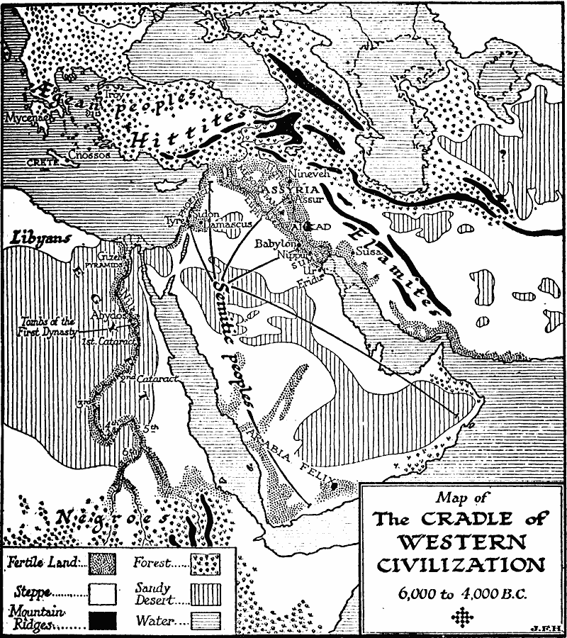
Description: A map of the Anatolia, Mesopotamia, and Egypt region circa 6,000 to 4,000 BC, subtitled "The Cradle of Western Civilization." The map is keyed to show the land types in the region, including fertile lands, steppes, mountain ridges, forests, sandy deserts, and water bodies. The map shows rivers, early cities, the extent of the distribution of the Semitic peoples, the general territories of the &Aelig;gean peoples, Hittites, Elamites, Libyans, and Negroes, and the territories of Egypt, Mycenæ, Mesopotamia, Assyria, Akkad, Sumer, and Phoenicia.
Place Names: Regional Miscellaneous, Asia, �Europe, �Afric
ISO Topic Categories: physical, �statistical, kWorldMedSea, kWorldAfroAsia, kWorldEurasia
Keywords: The Cradle of Western Civilization, physical, �statistical, physical features,
geological, vegetation, physical, �statistical, kWorldMedSea, kWorldAfroAsia, kWorldEurasia, Unknown, 6,000 to 4,000 BC
Source: H. G. Wells, The Outline of History (New York, NY: The Macmillan Company, 1921) 133
Map Credit: Courtesy the private collection of Roy Winkelman |
|