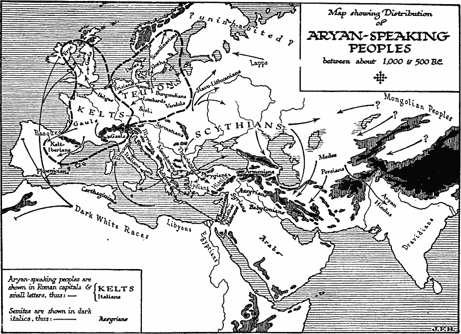
Description: A map of Europe, western Asia, and northern Africa, showing the distribution and pattern of dispersal of Ayrian–speaking peoples throughout the region between about 1,000 and 500 BC. The map shows the boundaries of the Kelts and Teutons, the territory of the Scythians, and the mountain systems of the region that presented barriers to migration. The map distinguishes between the Ayrian–speaking peoples and the Semites, and shows the direction of migration for various groups.
Place Names: Regional Miscellaneous, Africa, �Asia, �Europ
ISO Topic Categories: physical, �statistical, kWorldEurasia, kWorldAfroAsia, kWorldEuroAfrica, kWorldMedSea
Keywords: Distribution of Aryan-Speaking Peoples, physical, �statistical, physical features, ethnological, physical, �statistical, kWorldEurasia, kWorldAfroAsia, kWorldEuroAfrica, kWorldMedSea, Unknown, 1000–500 BC
Source: H. G. Wells, The Outline of History (New York, NY: The Macmillan Company, 1921) 237
Map Credit: Courtesy the private collection of Roy Winkelman |
|