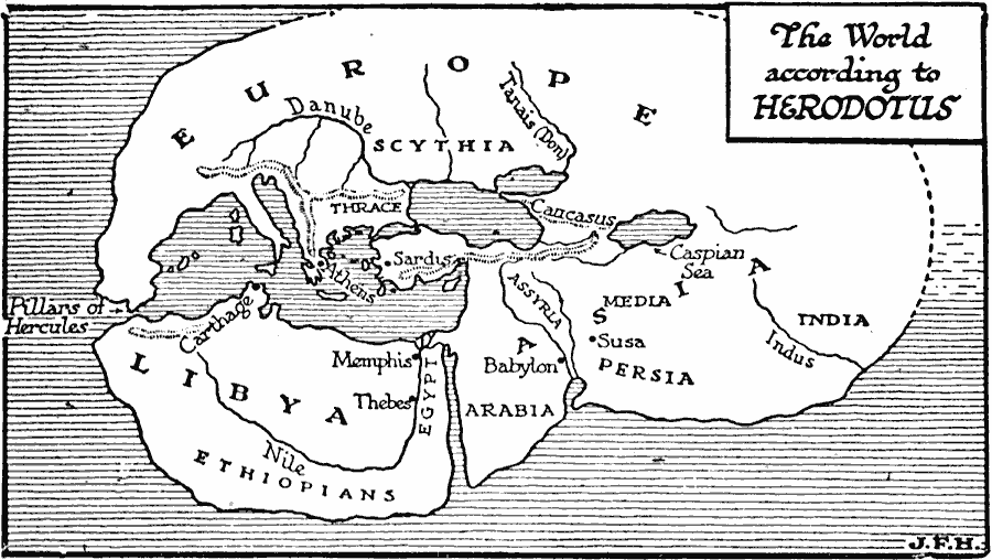
Description: A map of the world as it was known to the Greek historian Herodotus of Halicarnassus (484–425 BC). The map shows the extent of Europe, Asia, and Africa known to the Greeks, including the Pillars of Hercules (Gibraltar) between the Mediterranean and Atlantic, the mountain systems in northern Africa, central Anatolia, Alps, and Caucasus, the rivers Nile, Danube, Tanais (Don), and Indus, the territories of Scythia, Thrace, India, Media, Persia, Assyria, Arabia, Egypt, and Libya, and the cities of Athens, Sardis, Carthage, Memphis, Thebes, Babylon, and Susa.
Place Names: Regional Miscellaneous, Asia, �Africa, �Europ
ISO Topic Categories: physical, kAncientGreece, kWorldMedSea
Keywords: The World According to Herodotus, physical, kAncientGreece, physical features, physical, kAncientGreece, kWorldMedSea, Unknown, 484–425 BC
Source: H. G. Wells, The Outline of History (New York, NY: The Macmillan Company, 1921) 287
Map Credit: Courtesy the private collection of Roy Winkelman |
|