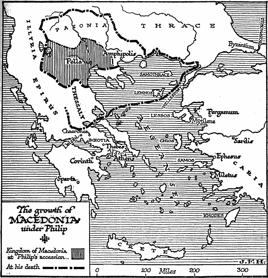
Description: A map of the region of Macedonia and Greece showing the expansion of Macedonia at the ascension of Philip II in 359 BC (shaded portion of map around the capital city of Pella), to the territory of Pæonia south through Thessaly and east to Hellespont at the time of his death (assassination) in 336 BC. Philip II was the father of Alexander the Great.
Place Names: Southeastern Europe, Macedonia, �Thrace, �Illyri
ISO Topic Categories: boundaries,
location,
inlandWaters,
oceans
Keywords: Growth of Macedonia Under Philip, physical, �political, kAncientGreece, physical features, major political subdivisions, boundaries,
location,
inlandWaters,
oceans, Unknown, 359–336 BC
Source: H. G. Wells, The Outline of History (New York, NY: The Macmillan Company, 1921) 313
Map Credit: Courtesy the private collection of Roy Winkelman |
|