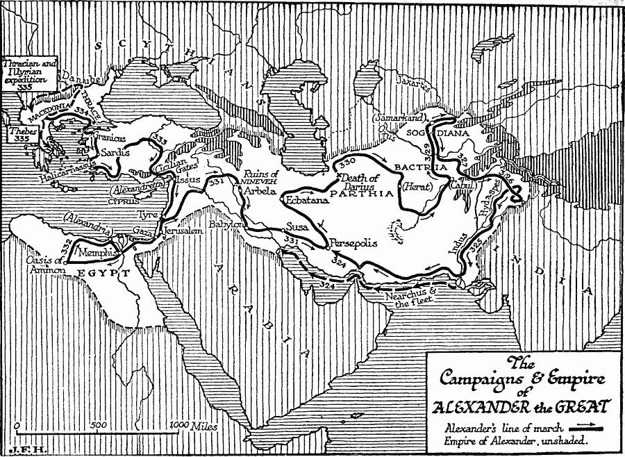
Description: A map of the empire and campaigns of Aledander the Great (336–323 BC), showing the territory (unshaded) under his control from Greece to Egypt, and Asia Minor to the Indus River. The map shows the routes and dates of the Thracian and Illyrian expedition (335 BC), the route to Thebes (335 BC), and the campaign from Macedonia to Anatolia, Syria, Egypt, Babylon, Persia, Parthia, Bactria, Sogdiana, and the Indus River. The map shows the sites of the Cicilian (Cilician) Gates, Issus, Alexandria (Egypt), the Oasis of Ammon, Persepolis, the site where Darius was killed, and the naval route of Nearchus from the mouth of the Indus to Susa in the Persian Gulf.
Place Names: Regional Miscellaneous, Asia, �Africa, �Europ
ISO Topic Categories: physical, �political, kAlexandertheGreat, kWorldMedSea, kWorldAfroAsia, kWorldEurasia
Keywords: Campaigns and Empire of Alexander the Great, physical, �political, kAlexandertheGreat, physical features, major political subdivisions, other military, physical, �political, kAlexandertheGreat, kWorldMedSea, kWorldAfroAsia, kWorldEurasia, Unknown, 335–324 BC
Source: H. G. Wells, The Outline of History (New York, NY: The Macmillan Company, 1921) 323
Map Credit: Courtesy the private collection of Roy Winkelman |
|