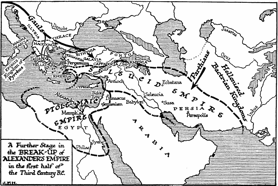
Description: A map showing a further stage of breakup of the empire established by Alexander the Great, which occurred in the first half of the third century BC. The map shows the boundaries of the Ptolemaic Empire, the remnants of the once larger Seleucid Empire, and the territories of Macedonia, Rhodes, Kingdom of Pyrrhus, and the Hellenised Bactrian kingdoms in the east. The map illustrates the invasion of the Gauls from the northwest, the Parthians from the northeast, and shows the general territories of Magna Graecia in southern Italy, Illyria, Thrace, and Hellas in the Balkans, and Pergamum, Bithynia, Galata, Cappadocia, Armenia, and Pontus in Anatolia.
Place Names: Regional Miscellaneous, Africa, �Asia, �Europ
ISO Topic Categories: physical, �political, kWorldMedSea, kWorldAfroAsia, kWorldEurasia
Keywords: Further Breakup of Alexander's Empire, physical, �political, physical features, major political subdivisions, physical, �political, kWorldMedSea, kWorldAfroAsia, kWorldEurasia, Unknown, 300–250 BC
Source: H. G. Wells, The Outline of History (New York, NY: The Macmillan Company, 1921) 339
Map Credit: Courtesy the private collection of Roy Winkelman |
|