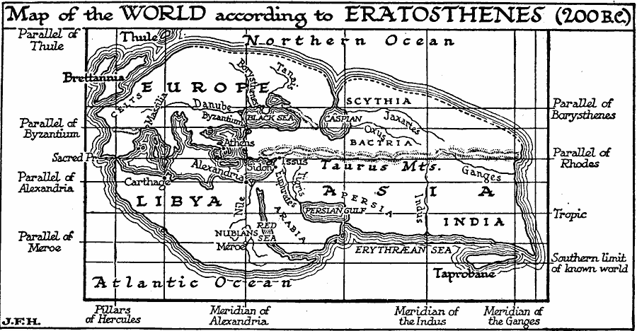
Description: A facsimile of the Eratosthenes map of the known world circa 200 BC. The map extends from the Iberian Peninsula in the west to the mouth of the Ganges River in the east, and from Thule and the Northern Ocean in the north to the southern limits of the known world south of the Nile River and Libya. The meridians and parallels on the map are based on known locations, such as the Meridian of Alexandria and the Parallel of Byzantium.
Place Names: Regional Miscellaneous, Africa, �Asia, �Europ
ISO Topic Categories: physical, kEarlyMapsFacsimile, kWorldMedSea, kWorldAfroAsia, kWorldEurasia
Keywords: World According to Erathosthenes, physical, kEarlyMapsFacsimile, physical features, physical, kEarlyMapsFacsimile, kWorldMedSea, kWorldAfroAsia, kWorldEurasia, Unknown, 200 BC
Source: H. G. Wells, The Outline of History (New York, NY: The Macmillan Company, 1921) 344
Map Credit: Courtesy the private collection of Roy Winkelman |
|