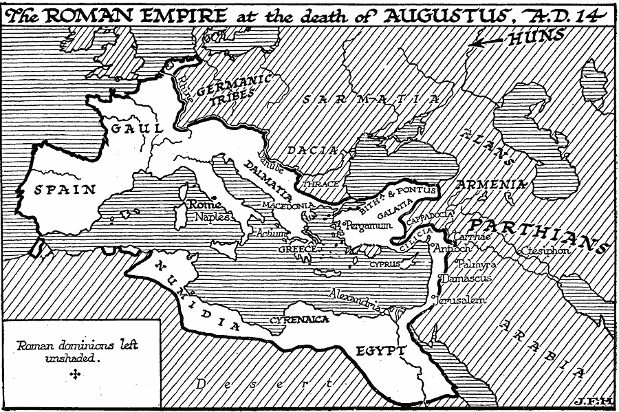
Description: A map of Europe, northern Africa, and western Asia, showing the extent of the Roman Empire at the death of Augustus in AD 14. The map shows the Roman domains of Spain, Gaul, Dalmatia, Macedonia, Greece, Bithynia, Pontus, Galatia, Cilicia, Egypt, Cyrenaica, and Numidia. Important Roman cities and sites shown include Rome, Naples, Actium, Pergamum, Antioch, Damascus, Jerusalem, and Alexandria. Lands not under Roman dominion include Sarmatia, Dacia, Thrace, Armenia, Cappadocia, and Arabia, and shows the territories of the Germanic tribes, Alans, Parthians, and the direction of Hun migration.
Place Names: Regional Mediterranean, Africa, �Asia, �Europ
ISO Topic Categories: physical, �political, kRomanEmpire, kWorldMedSea, kWorldAfroAsia, kWorldEurasia, kWorldEuroAfrica
Keywords: Roman Empire at the death of Augustus, physical, �political, kRomanEmpire, physical features, physical, �political, kRomanEmpire, kWorldMedSea, kWorldAfroAsia, kWorldEurasia, kWorldEuroAfrica, Unknown, AD 14
Source: H. G. Wells, The Outline of History (New York, NY: The Macmillan Company, 1921) 448
Map Credit: Courtesy the private collection of Roy Winkelman |
|