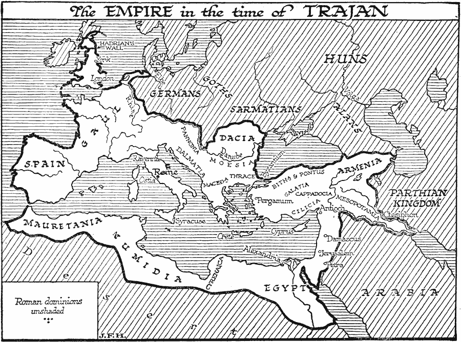
Description: A map of Europe, northern Africa, and western Asia, showing the extent of the Roman Empire in the time of Trajan (Marcus Ulpius Nerva Traianus AD 53–117). The map shows the Roman domains of Spain, Gaul, Britannia, Dacia, Moesia, Dalmatia, Macedonia, Greece, Bithynia, Pontus, Galatia, Cilicia, Cappadocia, Armenia, Mesopotamia, Egypt, Cyrenaica, Numidia and Mauretania. Important Roman cities and sites shown include Rome, Ostia, Syracuse, Ravenna, Byzantium, Pergamum, Antioch, Damascus, Jerusalem, Petra, Ctesiphon, Alexandria, London, York, and Hadrian's Wall. Lands not under Roman dominion include the Parthian Kingdom, Arabia, and the territories of the Germans, Goths, Sarmatians, Alans, and the Huns.
Place Names: Regional Mediterranean, Africa, �Asia, �Europ
ISO Topic Categories: physical, �political, kRomanEmpire, kWorldMedSea, kWorldAfroAsia, kWorldEurasia, kWorldEuroAfrica
Keywords: Roman Empire in the Time of Trajan, physical, �political, kRomanEmpire, physical features, major political subdivisions, physical, �political, kRomanEmpire, kWorldMedSea, kWorldAfroAsia, kWorldEurasia, kWorldEuroAfrica, Unknown, AD 117
Source: H. G. Wells, The Outline of History (New York, NY: The Macmillan Company, 1921) 453
Map Credit: Courtesy the private collection of Roy Winkelman |
|