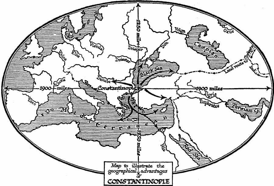
Description: A map illustrating the geographical advantages of Constantinople as the capitol of the Byzantine or Eastern Roman Empire in AD 330. The map shows Constantinople centered in an oval 3800 miles east to west by 2500 miles north to south, essentially the extent of the known world at the time. This map shows the strategic trade and military access to the Mediterranean, Black Sea, Danube River, Dnieper River, the land route to Turkestan and India, Antioch and the Silk Road, and Alexandria at the mouth of the Nile River. "Very early during the imperial period the unsuitability of the position of Rome as a world capital, due to the Roman failure to use the sea, was felt. The destruction of Carthage and Corinth had killed the shipping of the main Mediterranean sea-routes. [...] It was Constantine the Great who determined upon the permanent transfer the center of imperial power to the Bosphorus." Wells, 1921, pp. 560-561.
Place Names: Regional Mediterranean, Africa, �Asia, �Europ
ISO Topic Categories: physical, kWorldMedSea, kWorldEurasia
Keywords: Geographic Situation of Constantinople, physical, physical features, physical, kWorldMedSea, kWorldEurasia, Unknown, AD 330
Source: H. G. Wells, The Outline of History (New York, NY: The Macmillan Company, 1921) 490
Map Credit: Courtesy the private collection of Roy Winkelman |
|