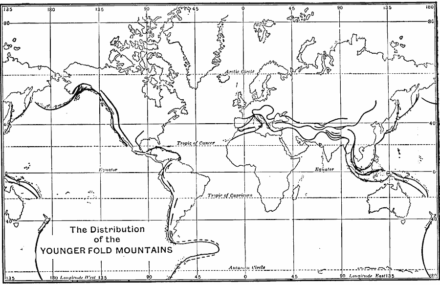
Description: A world map from 1915 showing the distribution of younger fold mountains across the earth. Folding refers to the compression process of mountain–building (opposed to rifting or pulling apart), and ‘Younger&rlqou; refers to the later 10 to 25 million year period (‘Older’ referring to over 200 million years of age)."A glance at the map of the world will suffice to show the importance of these directions. Only a very few mountain ranges or coast lines run from north to south or from east to west." — Williams, 1915, p. 47.
Place Names: A Complete Map of Globes and Multi-continent, Africa, �Asia, �Australia, �Europe, �North America, �South Americ
ISO Topic Categories: oceans
Keywords: The Distribution of Younger Fold Mountains, physical, �distribution of younger fold mountains, physical features, oceans, Unknown, 1915
Source: Graeme Williams, ed., The World We Live In (London, England: Waverley Book Company, LTD, 1915) 54
Map Credit: Courtesy the private collection of Roy Winkelman |
|