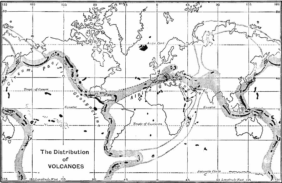
Description: A world map from 1915 showing the distribution of volcanoes and belts of volcanic activity across the earth. The map shows areas of existing volcanoes in black, belts of existing volcanic activity in hatchures, and belts of extinct activity. The map shows the Circum–Pacific Geosyncline and Alpine Geosyncline. The Geosyncline Theory of vertical crustal movement is an obsolete concept from the late 19th century, which has been replaced by the concept of Plate Tectonics, however, it should be noted that the Circum–Pacific Geosyncline corresponds well with the margins of the Pacific Plate (Ring of Fire).
Place Names: A Complete Map of Globes and Multi-continent, Africa, �Asia, �Australia, �Europe, �North America, �South Americ
ISO Topic Categories: oceans
Keywords: The Distribution of Volcanoes, physical, �distribution of volcanoes, �circum pacific geosyncline, �alpine geosyncline, physical features, oceans, Unknown, 1915
Source: Graeme Williams, ed., The World We Live In (London, England: Waverley Book Company, LTD, 1915) 54
Map Credit: Courtesy the private collection of Roy Winkelman |
|