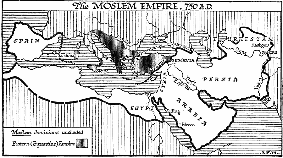
Description: A map showing the extent of the Islamic Omayyad Caliphate in AD 750, from the Pyrenees in Spain, northern Africa and Egypt, Arabia, Syria, Armenia, Persia, to Kashgar in Turkestan. This map also shows the territories of the Byzantine Empire at the time from Sardinia and Sicily to the Taurus mountain range, which formed the boundary with the Moslem Empire.
Place Names: Regional Miscellaneous, Africa, �Asia, �Europ
ISO Topic Categories: physical, �political, kWorldMedSea, kWorldAfroAsia, kWorldEurasia, kWorldEuroAfrica
Keywords: The Moslem Empire under the Omayyad Caliphate, physical, �political, physical features, major political subdivisions, physical, �political, kWorldMedSea, kWorldAfroAsia, kWorldEurasia, kWorldEuroAfrica, Unknown, AD 750
Source: H. G. Wells, The Outline of History (New York, NY: The Macmillan Company, 1921) 590
Map Credit: Courtesy the private collection of Roy Winkelman |
|