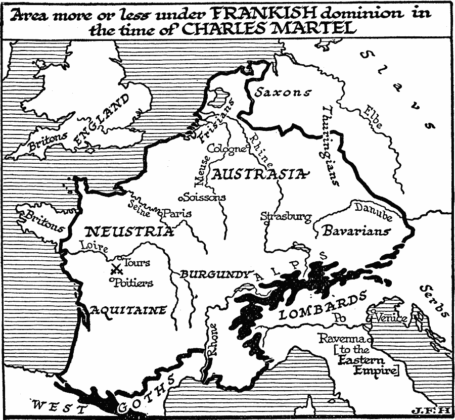
Description: A map showing the area more or less under Frankish dominion in AD 732, the time of Charles Martel, including Aquitaine, Neustria, Burgundy, Austrasia, and the territories of the Frisians and Bavarians. The site of the Battle of Tours (Battle of Poitiers) is shown, where Frankish forces under Charles defeated the army of the Umayyad Caliphate, thereby halting Islamic expansionism into Europe. The map shows major rivers and important cities of the time, as well as the territories of the Britons (Brittany), Saxons, Lombards, and Goths
Place Names: Western and Central Europe, Aquitaine, Neustria, Burgundy, Austrasia, Frisian, Bavaria, Byzantine Empire, Rhine River, Danube River, Poitiers, Paris
ISO Topic Categories: boundaries,
oceans,
location,
inlandWaters
Keywords: Frankish Domain in the Time of Charles Martel, physical, �political, physical features, major political subdivisions, boundaries,
oceans,
location,
inlandWaters, Unknown, A.D. 732
Source: H. G. Wells, The Outline of History (New York, NY: The Macmillan Company, 1921) 611
Map Credit: Courtesy the private collection of Roy Winkelman |
|