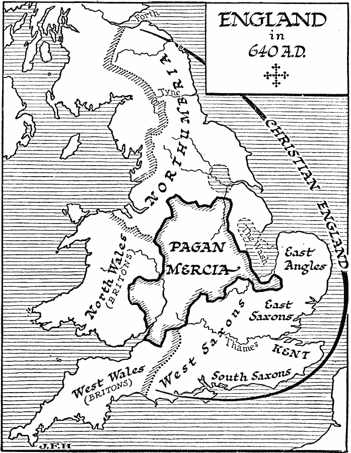
Description: A map of England in AD 640 in the time of the Anglo–Saxon kingdoms and of Penda of Mercia, the last pagan Anglo–Saxon king. The map shows the extent of Christian England in Northumbria and the Anglo–Saxons of the southeast, the territories of the Britons in North Wales and South Wales, and the territory of pagan Mercia.
Place Names: United Kingdom,
ISO Topic Categories: location,
oceans,
inlandWaters,
boundaries
Keywords: England, physical, �statistical, �political, physical features, major political subdivisions, ethnological, location,
oceans,
inlandWaters,
boundaries, Unknown, AD 640
Source: H. G. Wells, The Outline of History (New York, NY: The Macmillan Company, 1921) 615
Map Credit: Courtesy the private collection of Roy Winkelman |
|