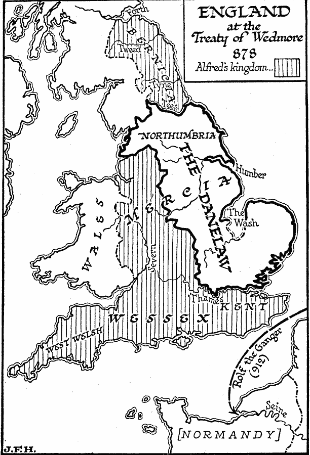
Description: A map of England at the time of the Treaty of Wedmore in AD 878. This map shows the Kingdom of Alfred of Wessex, the territory of the Danelaw (lands under Viking expansion over the Anglo–Saxons), and the route of Rolf the Ganger (Rollo, the Walker), the Viking leader who founded the principality now known as Normandy. The Treaty of Wedmore refers to the surrender by the Viking army to King Alfred of Wessex at Edington.
Place Names: United Kingdom,
ISO Topic Categories: oceans,
location,
inlandWaters,
boundaries
Keywords: England, physical, �political, physical features, major political subdivisions, oceans,
location,
inlandWaters,
boundaries, Unknown, AD 878
Source: H. G. Wells, The Outline of History (New York, NY: The Macmillan Company, 1921) 617
Map Credit: Courtesy the private collection of Roy Winkelman |
|